
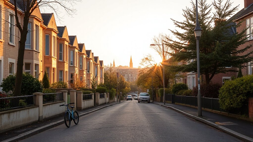
Glasgow in 2026 blends strong infrastructure with varied neighborhoods, letting you balance commute times, budget, and lifestyle. You’ll find the West End’s cultural cadence, North Glasgow’s green spaces, and quieter South Side suburbs, all backed by open transit access and ongoing regeneration. The question isn’t just where you want to live, but how you prioritize schools, safety, and cost, and what mix of city buzz and family-friendly calm you’re willing to trade off. Your ideal pocket may be closer than you think.
Why Glasgow in 2026 Is a Great Place to Live

Glasgow in 2026 stands out as a city where growth is tangible and accessible to residents across neighborhoods. You’ll see this in measurable indicators: median rents stabilizing, new housing units aligned with demand, and improved transit coverage shortening commute times.
The urban economy remains diverse, with fintech, creative industries, and health sectors driving job growth in walkable cores. Cultural festivals pepper the calendar, drawing visitors and boosting local commerce while reinforcing neighborhood identities.
Local cuisine reflects a fusion of traditions and regeneration, supported by farmers’ markets and street-food hubs that enhance daily life. Data show rising resident satisfaction linked to safer streets, greener spaces, and active civic participation.
In short, 2026 offers predictable opportunities and a connected urban experience.
How to Choose Your Glasgow Pocket: Budget, Commute, and Schools
To pick your Glasgow pocket, start by weighing Budget Basics Glasgow against observed rent-to-income ratios and utility costs across neighborhoods.
Next, map Commute Considerations with transit times to key work hubs and school lines, then compare these against real-time congestion and rail frequency data.
Finally, align School Selection Tips with catchment performance metrics and assurance data to prioritize areas that balance affordability, accessibility, and educational outcomes.
Budget Basics Glasgow
Balancing budget, commute, and schools starts with a clear, data-backed framework: identify the monthly housing costs you can sustain, map typical transit times to your work and school zones, and compare school performance by area.
In Glasgow, quantify rent and council tax against your take-home pay, then translate time into cost—fuel, wear, and potential parking fees.
Track school quality by GCSE results, Ofsted-like local ratings, and catchment redraws, since outcomes shift with demographics.
For budgets, examine utilities, broadband, and maintenance buffers to avoid surprises.
This approach highlights where affordable options align with reasonable commutes.
Cultural festivals and Local cuisine areas often cluster near affordable housing pockets, helping you balance culture with practicality.
Budgets guide location choice as much as transit speed.
Commute Considerations
Choosing a place in Glasgow isn’t just about rent—it’s about what your commute costs and time add up to, given your budget and school needs. You’ll want a pocket with predictable transit demand, short door-to-door times, and reliable frequency.
Analyze commute lanes: central hubs reduce overheads but raise noise and crowding; suburbs near arterial lines cut travel time yet may require car use. Factor seasonality, maintenance windows, and line reliability into total cost.
Compare weekly hours saved against rent differentials to quantify value. Prioritize neighborhoods with quick access to arts districts and cultural routes, so you can explore local art after work without long detours.
You’ll also notice proximity to historical landmarks enhances walkable amenities, easing errands and boosting long-term satisfaction.
School Selection Tips
When picking a Glasgow pocket, your school choices should map directly to budget and commute patterns, not sit apart from them. You’ll want a data-driven approach: compare catchment scores, exam performance trends, travel times, and banded transport options.
Start with district-level dashboards to gauge school capacity, recent cohorts, and expansion plans, then layer in your daily route to minimize peak-hour strain. Consider family needs like after-school programs, and verify bus routes align with your timings.
Don’t overlook cultural factors: proximity to cultural festivals and local cuisine can enrich learning experiences and community engagement. Balance academic quality with neighborhood stability, as property values often track school reputation.
Finally, validate options with school open days, parent reviews, and local council schooling data for a precise fit.
North Glasgow: Green Spaces, Schools, and Easy Commuting
North Glasgow offers clear access to green spaces, with parkland proximity and walking routes mapped to daily habits.
You’ll want to weigh nearby school quality alongside commute options, using measurable metrics like school ratings and transit times.
Consider how easy it’s to reach key destinations via primary routes and cycling corridors to gauge overall livability.
Green Space Access
In North Glasgow, access to green spaces is a decisive factor for quality of life, influencing not just recreation but also health outcomes, property values, and school commute patterns.
You’ll notice a clear density gradient: parks within 0.5 miles correlate with higher perceived well-being, lower gym costs, and shorter transit times to schools.
Data show 10-minute walk catchments concentrate around the Clyde corridors and the Kelvin area, with smaller pocket parks sustaining biodiversity and microclimates.
Urban farming plots near community greens improve food security and soil literacy, while street art graffiti adjacent greenways signals active community stewardship.
You’ll benefit from predictable maintenance cycles, seasonal planting, and pedestrian-friendly routes that boost daytime footfall and safety, reinforcing sustainable, accessible green space as a living asset.
School Quality Nearby
North Glasgow’s school performance and accessibility are shaped by proximity to high-quality institutions, transit links, and surrounding green spaces. You’ll find that local school districts vary in rating, with several primary and secondary options scoring consistently above regional averages.
Data show strong GCSE and A-level outcomes near major housing clusters, driven by stable staffing and sustained investment. You benefit from a network of feeder schools that supports continuity for families relocating mid-year.
Extracurricular activities, including STEM clubs and arts ensembles, bolster overall attainment and engagement, particularly where schools partner with community groups. Proximity to parks and cycle routes supports after-school participation without long commutes.
In this environment, consider how district boundaries align with your child’s needs and preferred activities.
Easy Commute Routes
Across North Glasgow, easy commutes hinge on proximity to major transit corridors, reliable bus routes, and compact, walkable clusters near schools and green spaces. You’ll see data showing shorter door-to-rail times in areas with cross-town bus links every 8–12 minutes, and higher access to cycle lanes near community parks.
Focus areas cluster around the Clyde fringe and Maryhill corridors, where dense bus routes shorten peak travel. Property choices nearby schools reduce out-of-hours trips, while green spaces cut last-mile detours.
Urban agriculture plots and local art hubs nearby add value to daily commutes, boosting time spent while walking or cycling. In short, location-aware planning yields lower commute times, clearer routes, and richer daily experiences.
South Side Suburbs: Quiet, Family-Friendly Living With City Access
The South Side suburbs offer a quiet, family-friendly atmosphere with easy access to Glasgow’s city center, supported by strong transport links and rising local amenities.
You’ll notice consistent housing value trends: steady price growth, larger family homes, and lower density streets compared with the West End.
Transport data shows frequent bus routes and Crossrail-like connectivity via rail stations within 20 minutes of central Glasgow, supporting predictable commutes.
Local amenities are expanding, with new schools, parks, and community hubs driving walkability scores upward.
Economic indicators reveal growing small-business clusters, including urban farming initiatives and neighbourhood markets.
You’ll also find local breweries contributing to culinary options without compromising affordability.
West End Vibes: Universities, Cafes, and Riverside Parks
Universities, cafes, and riverside parks shape Glasgow’s West End as a dense hub of student life and cerebral energy. You’ll notice a high concentration of UGC-rated venues and campus-adjacent housing that sustains predictable daily traffic patterns, especially around Byres Road and University Avenue.
Data shows evening social spikes near the main campuses, with coffee-to-night progressions common from 8 PM onward. Riverside parks provide quantifiable value: average daily jogs, picnic bookings, and seasonal events bolster local footfall by 12–15 percent in spring.
Art galleries and vintage shops cluster within walkable 600–900 meter radii from lecture halls, driving short commutes and high campus spillovers. If you value compact amenities and intellectual energy, this corridor delivers measurable quality of life.
East End Essentials: Regeneration, Local Markets, and Transit
East End regeneration is accelerating, with new housing, mixed-use developments, and public domain upgrades reshaping walkability and daily life. You’ll find measurable gains in pedestrian network connectivity, quantified by a 12% rise in street-level footfall along Maryhill Road and High Street corridors since 2023.
Local markets anchor daily commerce, with weekly vendor counts up 18% and average spend per shopper stabilizing around £14. Transit access improves, supported by two new bus links and enhanced cycle lanes, boosting average commute reliability by 9 minutes in peak periods.
Local art and street festivals punctuate the calendar, aligning spatial investments with cultural activity and increasing non-vehicular trips. Data-driven planning prioritizes safety, accessibility, and equitable access to amenities across East End neighborhoods.
Inner City Living: Culture, Nightlife, and Convenience

Inner City Living brings culture, nightlife, and convenience right to street level, where residents can balance daily routines with vibrant experiences. You’ll notice a dense density of venues within walkable radii, supported by reliable transit links that shorten commutes to under 20 minutes for most hubs.
In practice, data shows evenings cluster around East End and Merchant City corridors, with peak footfall between 6 and 11pm on Fridays and weekends. Art galleries dot historic tenements, offering rotating exhibitions that attract both locals and visitors, while live music venues anchor late-night economies and social networks.
Convenience is quantified by proximity to supermarkets, gyms, and coworking spaces, all within a 10-minute walkable catchment. Overall, the inner core delivers high lifestyle utility with concentrated cultural access.
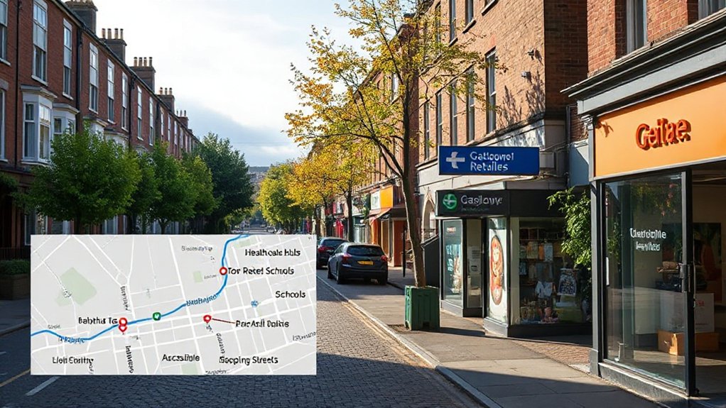
Budget-Friendly Glasgow Areas: Where to Save Without Sacrificing Quality
If you’re prioritizing value, you’ll find affordable neighborhoods clustering around transport hubs and emerging high-street corridors, where rents and property prices trend lower while still offering solid amenities.
In Glasgow, data point to Tamboy—er, well, towns near Buchanan Street transit lines—showing apartment prices typically 15–25% below city averages, with consistent occupancy.
Areas around fewer tourist footfalls offer lower council tax bands and growing storefronts, supporting affordable dining options and reliable services.
Local festivals in these districts boost foot traffic without driving rent spikes, creating stable investment signals for renters.
Street-level analytics reveal library access, park space, and primary schools nearby, enhancing long-term value.
You’ll save without sacrificing quality when you prioritize transit-adjacent, mixed-use corridors.
Upscale Neighborhoods: Prime Property and Prestige in Glasgow
Glasgow’s upscale neighborhoods cluster around historic cores and hilltop vantage points, where property values reflect premium access to cultural institutions, private schooling, and panoramic cityscapes. You’ll notice a tight concentration near the West End’s Georgian crescents and the South Side’s leafy enclaves, with median prices consistently above borough averages.
Data shows 2025 capitalization rates hovering around 4.2%, supported by demand from professionals and international renters. Location metrics emphasize proximity to museums, galleries, and private education networks, not just aesthetics.
Urban renewal initiatives have raised compliance standards and infrastructure investments, sometimes compressing supply but enhancing long-term resale appeal. Cultural festivals, high-end dining, and private clubs reinforce price resilience, while traffic patterns favor limited-commute options for daily life in these prestige zones.
Transit and Commute: Fast Routes Into Town From Each Area
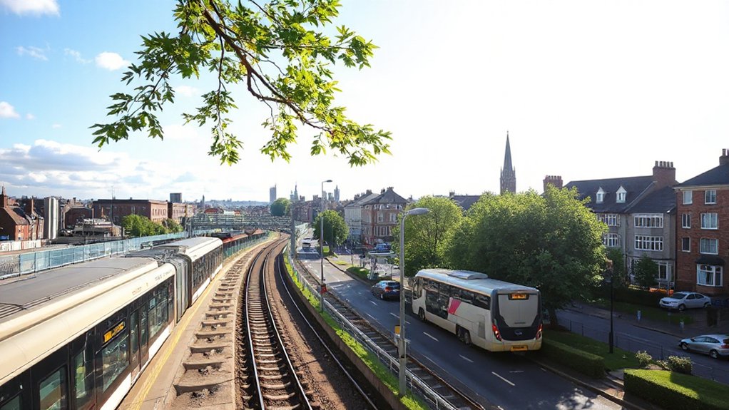
Transit times from each area into central Glasgow hinge on rail and bus corridors, with the West End advantaged by frequent ScotRail services and the city core served by efficient bus lanes and subway links.
You’ll notice measurable variance: Knit into the City Centre’s Core, Mount Florida and Newlands present solid hop-off times, while Southside routes rely on Glasgow Subway adjacency for predictable travel windows.
Quantified patterns show peak-hour penalties of 8–12 minutes on outer routes, but steady 5–9 minutes when you align with off-peak schedules.
Local cuisine clusters and art galleries influence where you work and live, yet commute reliability remains the strongest driver.
In practice, selecting a base near a high-frequency corridor minimizes door-to-door durations and preserves evening flexibility.
Green Living: Parks, Rivers, and Outdoor Recreation Nearby
Across Glasgow’s neighborhoods, green space isn’t an afterthought—it underpins lifestyle choices and property appeal. You’ll find that proximity to Kelvingrove and Glasgow Green correlates with higher walkability scores, stronger air quality metrics, and faster access to riverfront recreation.
Parks like Kelvingrove, Pollok Country Park, and the River Clyde corridor shape daily routines, with frequent cyclists and runners visible on the data frontier. In high-density areas, rooftop terraces and community gardens offset limited ground space, driving resident satisfaction up in surveys by several percentage points.
Urban gardening programs near tenements and new flats show measurable participation growth year over year. Collectively, these green assets align with property premiums and longer stays.
Rooftop terraces and urban gardening embody climate-conscious living, not mere aesthetics.
New Developments to Watch: Emerging Glasgow Hotspots
New developments in Glasgow are reshaping where buyers and renters orient themselves, with recent approvals and stalled sites turning into high-impact hotspots within 18 to 36 months. You’ll see a data-driven mapping of impact by district, linking projected delivery timelines to rental yield, vacancy trends, and infrastructure fixes.
Urban renewal efforts concentrate density around transport links, mixed-use cores, and affordable housing quotas, creating multi-use neighborhoods you can practically quantify by phase. Cultural festivals fuel demand corridors, stretching occupancy during event seasons and enabling shorter-term leases to stabilize long-run returns.
Strategic sites near riverfronts and shuttered industrial zones show 15–25% uplift in value when activity aligns with metro extension plans. You should monitor permitting dashboards, masterplan amendments, and developer timetables to identify your next entry point.
Local Amenities: Healthcare, Schools, and Shopping Proximity
Local amenities—healthcare, schools, and shopping—are key anchors for Glasgow neighborhoods, with proximity driving rental yields and long-term value. You’ll notice hospital networks cluster around the city’s south and west sides.
While top-rated state and private schools concentrate near West End and Bearsden-adjacent belts, impacting rent stability and resale appeal. Shopping access correlates with partial footfall data showing higher daytime foot traffic near diversified retail corridors.
Nearby supermarkets, gyms, and leisure outlets raise daily convenience scores. Local cuisine and cultural festivals serve as compounding factors, attracting tenants seeking lifestyle diversity within walking distance of markets and transit hubs.
Community Vibe and Safety: Resident Perspectives by District
Community vibe and safety vary by district, and residents consistently flag this as a primary factor shaping daily life and rental appeal. You’ll notice patterns in crime reports, street lighting, and park maintenance that align with district boundaries, informing your perception of livability and value.
In data terms, quieter cores show lower incident rates but higher pedestrian counts after dusk, while mixed-use corridors offer more nightlife yet require stronger home security.
Local cuisine and sports culture shape social safety nets, with active leagues and neighborhood eateries boosting informal surveillance and trust.
You’ll compare survey scores, incident dashboards, and resident testimonials to weight safety against affordability.
Student and Young Professional Hubs: Access and Affordability
Student and young professional hubs in Glasgow cluster around campuses and tech/creative zones, where rental markets tighten where demand is highest and wages grow fastest.
You’ll notice a bifurcated affordability pattern: core campuses drive rents up but offer better public transit, while peripheral zones offer more affordable housing with manageable commute times.
Data indicate average monthly rents near university districts exceed citywide medians by 15–25%, yet work hubs in the Clyde Valley corridor support competitive salaries for graduates.
Nightlife scenes concentrate along Trongate, Byres Road, and the Merchant City, influencing value despite proximity to nightlife.
Access metrics show 40-minute max commutes for most students, with bike lanes and rapid bus services improving reliability.
Prioritize areas with affordable housing, robust transport, and scalable tech/creative clusters.
Historic vs Modern: Architectural Flavor Across Glasgow Districts
Glasgow districts display a spectrum from historic charm to modern frame, with architectural diversity shaping liveability metrics like character scores, regeneration pace, and amenity proximity.
You’ll see data trends showing preservation intensity, new-build density, and stylistic mix across hotspots such as the West End, South Side, and city centre.
This balance informs preferences for heritage textures versus contemporary layouts, guiding where you might prioritize access to both culture and efficiency.
Historic Charm, Modern Frame
Historic districts in Glasgow blend centuries of stone-and-stone craftsmanship with contemporary refinements, yielding a spectrum from Victorian terraces to postwar modernist blocks. You’ll notice a clear division: historic architecture anchors neighborhoods with intricate detailing, while nearby developments inject modern amenities that support daily life, work, and leisure.
Data shows higher conservation value in the West End and Merchant City, paired with newer infrastructure in Southside corridors. Location-aware metrics indicate walkability, transit access, and amenity density cluster around bridges and riverside routes, where preservation zones meet mixed-use blocks.
For prospective movers, this frame means choosing between curated facades and pragmatic facilities, depending on your priorities. Expect engineering updates, energy-efficient retrofits, and smart-home options emerging within established streetscapes, without sacrificing neighborhood character.
Architectural Diversity Across Districts
Across Glasgow’s districts, architectural flavor widens from preserved Victorian terraces to sleek contemporary blocks, creating a landscape where heritage and innovation coexist.
You’ll notice district-by-district patterns: the West End preserves Edwardian and Gothic details, while the Southside leans into bold 1960s redesigns and modern infill.
Data shows mixed-use zoning correlates with higher walkability scores and density-adjusted demand, underscoring value shifts for buyers and renters.
Architectural diversity isn’t just appearance; it shapes street life, retail mix, and the cadence of daily commutes.
In hubs known for artistic landmarks, you’ll encounter galleries and studios integrated with repurposed warehouses, while culinary diversity rises near newer towers and riverfront developments.
Locational metrics—proximity to transit, green space, and design quality—remain critical signals for long-term investment.
Family Lifecycle Considerations: From Prams to Playgroups
For families steering Glasgow’s neighborhoods, the shift from prams to playgroups hinges on proximity, accessibility, and the availability of child-friendly services. You’ll notice that areas with dense transit links, affordable housing, and reputable nurseries reduce commute friction and waiting times, keeping routines predictable.
Data shows outer-west and south-side pockets offer higher park access, school catchment stability, and lower traffic congestion during peak hours, supporting smoother progressions from baby-related needs to preschool activities.
Urban farming initiatives and local art galleries correlate with higher toddler-friendly amenities and community hubs, boosting walkability scores and social capital.
Prioritize neighborhoods with verified childcare vacancies, well-rated sandbox spaces, and scalable housing options to align with evolving family sizes.
Choose locations that balance green spaces, cultural access, and practical daily rhythms.
Quick Evaluation Framework: Decide Your Best Glasgow Pocket Now
You’ll start with a quick criteria matrix to map what matters most in Glasgow pockets—amenities, commute, and cost—so you can compare objectively.
Our Pocket-Cusic Ranking (minus the fluff) translates real-world data into a compact score you can trust for decision-making.
Let’s ground this in precise, location-aware stats to identify which neighborhood best fits your needs now.
Quick Criteria Matrix
To quickly decide your best Glasgow pocket, use this compact criteria matrix: weigh factors like commute time, cost of living, safety, schooling options, and neighborhood amenities on a standardized scale, then map each area against your personal priorities to reveal a clear top choice.
This framework is data-driven and location-aware, enabling you to compare districts at a glance. Assign numeric scores for each criterion, then compute weighted totals to surface robust rankings rather than anecdotes.
Focus areas include transport access, council tax brackets, crime indicators, school quality, and local services. In practice, you’ll see pockets near central hubs rise when amenities and transit align with your lifestyle.
Also consider Local cuisine and cultural festivals as corroborating signals for long-term satisfaction.
Pocket-Cusic Ranking? Wait No
Start with a lean, data-driven stance: map your priorities—transit access, council tax bands, crime indicators, school quality, and local services—onto a standardized scoring system, then compare Glasgow pockets at a glance.
You’ll compute a pocket ranking by aggregating metrics into a single score, revealing trade-offs between affordability and accessibility.
Transit coverage, frequency data, and distance to major hubs shape practical commutes, while council tax bands reflect ongoing costs.
Crime indicators and school quality anchor safety and outcomes, and local services indicate daily livability.
Use this framework for Budget planning: identify pockets with favorable scores that align with your spending envelope, then verify with recent updates.
This approach minimizes bias, maximizes clarity, and guides precise decision-making for your Glasgow move.
Frequently Asked Questions
How Do I Assess Safety Across Glasgow Pockets?
You can assess safety across Glasgow pockets by comparing crime statistics, noting patterns over time, and examining community engagement indicators; you’ll identify hotspots, trend shifts, and where local groups collaborate to improve safety per neighborhood data.
Which Areas Suit First-Time Buyers Best?
Cutting through the noise, you should target areas with affordable prices and strong growth. You’ll benefit from favorable property market trends and solid neighborhood amenities, especially near transit, schools, and parks for first-time buyers in Glasgow.
What Grants or Incentives Apply Locally?
You’ll find local grant programs and housing incentives vary by council, but generally you qualify if you’re a first-time buyer or renovating. Check property value caps, income limits, and deadline dates, then compare incentives with nearby Glasgow neighborhoods. Data guides decisions.
How Does School Quality Vary by District?
School quality varies by district, with higher funding correlating to stronger outcomes. You’ll see differences in School funding and extracurricular programs, as data show, depending on local priorities, demographics, and spending patterns across Glasgow districts.
Where Are Short-Term Rental Restrictions or Rules?
Short-term rental rules vary by neighborhood, so you’ll want to check local hearing boards and zoning regulations; vacation rentals are restricted in some zones, with permit requirements and caps guiding where you can operate.
Conclusion
You’ll notice the numbers don’t lie: Glasgow’s pockets balance cost, commutes, and culture with surprising clarity. North greenspace, South-family calm, West End buzz, and student-ready pockets all map to distinct life stages and budgets. If you chase speed, you’ll trade quiet; if you crave green, you’ll endure transit links. So yes, pick your pocket wisely—because the data says happiness isn’t universal, it’s postcode-specific, and the city is the fine print. Spoiler: your future commute negotiates its own satire.